The great mountain covered with vegetation that rose alone in the fertile plain had always been a familiar presence.
Due to its particular conformation, with the deep valleys that furrowed its sides and the broken top, it revealed a very ancient origin. And from time immemorial, in fact, it contributed to the harmony of the landscape that crowned the ever-expanding city of Pompeii, towards the interior, with its agricultural suburbs that reached the slopes of the mountain, and as far as the sea, where the settlement it stretched further and further along the coast. For the Roman patricians they were ideal lands in which to invest their wealth in sumptuous leisure villas facing the sea or in rustic villas in the countryside, which ensured excellent wine, exquisite oil, copious fruits and tasty vegetables. An ideal condition, until the earth shook violently in that year 62 AD, upsetting life in Pompeii and nearby towns. But even then no one had ever thought that the event could be connected to the mountain dominating the landscape.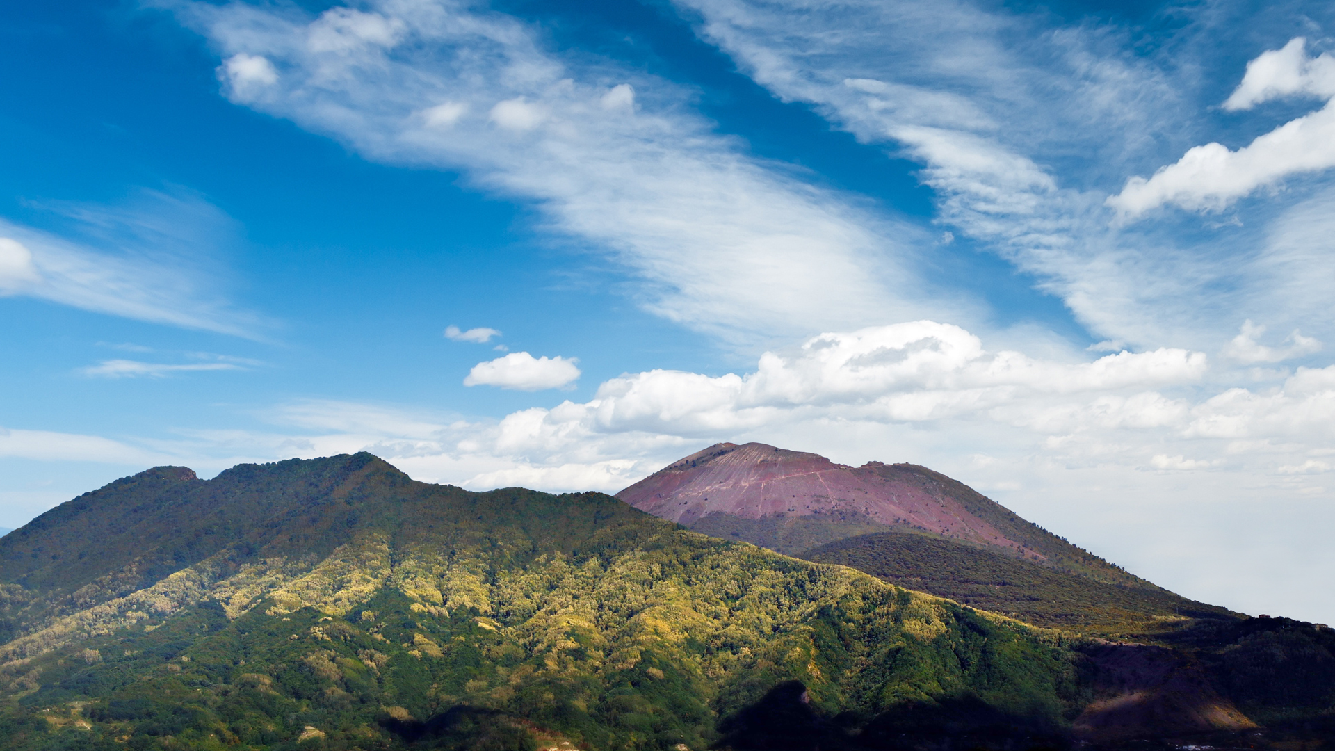
The peaceful Somma from the remote turbulent past in the plain of Pompeii
Peaceful and harmless. Such had appeared to the groups of Osci, who in the 9th century BC. they had begun to take possession of that territory in a strategic position near the sea and at the mouth of the Sarno. And even later, the Greeks, the Etruscans and the Samnites, who had settled there, before Pompeii became a Roman city, had not had any trouble. No Italic people nor the Hellenic colonizers could have memory of the true nature of that giant or knowledge of its much more remote turmoil. Because it was not a "simple" mountain, the Somma, but a volcano, with about 24,000 years of history in an area where volcanic phenomena had begun to reveal themselves more than 370,000 years earlier.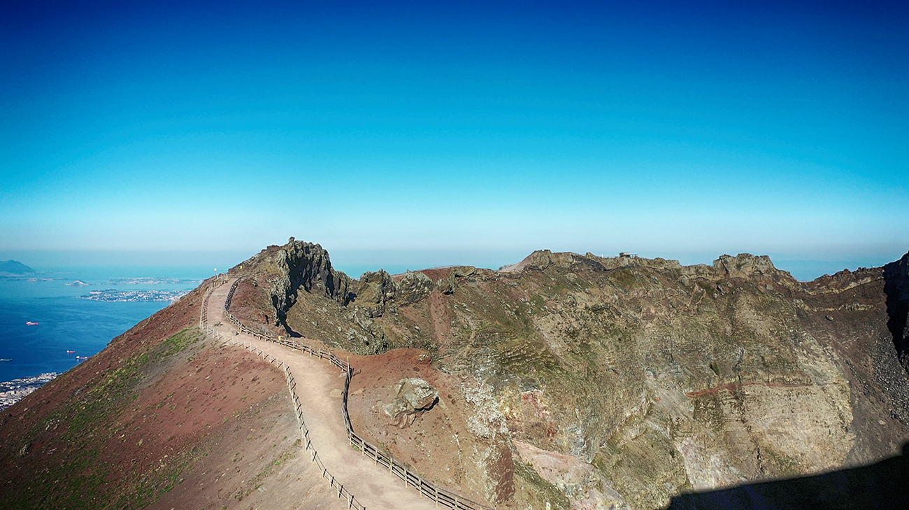
In remote times, the Somma had been much higher than the inhabitants of its surroundings had known it later: it reached 1600 or 1800 meters, perhaps even more. But violent eruptions had shaken and resized it, progressively changing its appearance. There had been three decisive events, all corresponding to Plinian eruptions, therefore explosive and with the expulsion of very viscous lava. The first, dating back to 18,000 years ago, known as the Polveri di Base eruption, already caused a reduction in height of about 200 meters. The second, the eruption of the Pomici di Mercato, which occurred 8 thousand years ago, destroyed other parts of the summit. The third, the eruption of the Pomici di Avellino, which 3400 years ago threw incredible quantities of pumice and volcanic ashes up to the current Avellino, destroying communities attributable to the Culture of Palma Campania, caused the south-western part of the volcano to collapse, creating a large caldera. All events that chronologically had long preceded the human presence in the surrounding plain. A very long phase of quiescence, then, for over nine centuries had presented the inhabitants of the area with a "normal" mountain about 1200 meters high and with a particular shape, with a large opening on the southern slope. The one that had been devastated by the Pomici di Avellino eruption.
The eruption that changed history
The earthquake of 62 had caused enormous damage to Pompeii. And brought the city's economy to its knees, which had taken a long time to recover. In fact, there was a complicated and expensive reconstruction to face, which was still in progress in that year 79 AD, destined to become a milestone in history.
The first signs had been several earthquakes in the previous days, but no one had connected them to the verdant mountain. Everything changed abruptly when a gigantic explosion was generated from inside the hill which caused a rain of pumice stones and the appearance of an immense column of materials, forty kilometers high. The disaster caught the Pompeians and the inhabitants of the nearby towns off guard. The large quantity of pumice submerged everything, causing the collapse of the structures in which many people had sought shelter and refuge. And later, the burning winds of the pyroclastic currents developed from the column which, traveling at a speed of 100 kilometers per hour, with temperatures of hundreds of degrees, wiped out all life even in Herculaneum, Stabia, Oplontis and along the coast.
A natural disaster unprecedented in history. Occurred, according to what had been handed down for centuries, on August 24th. Data that had been deduced from the letter in which Pliny the Younger had told Tacitus of the cataclysm that had also killed his uncle Pliny the Elder. A chronology that archaeological research has recently questioned, moving the eruption by a couple of months to 24 and 25 October. In fact, the transcriptions of the letter in medieval times bear different dates, but there would be no doubt by now that it was already autumn when the volcano showed its true nature.
The new Vesuvius inside the old Somma
 The Plinian eruption, which changed the face of a vast area, did not change the structure of the old Somma. But inside its caldera a new volcanic cone arose, which would since then have been identified as the Great Cone of Vesuvius. An example of what geologists call enclosed volcano, formed by an external building now extinct with a partially collapsed crater wall, inside which there is another active volcano. Enlarged and modeled up to its unmistakable current form by the numerous successive sub-Plinian eruptions, as they were less intense than in the Roman era. In particular, the eruption of 1036 was distinguished for the first time by the emission of lava. A period of quiescence followed from the 13th century, interrupted in 1631. When a very violent explosive eruption occurred on 16 December, forming a new mouth on the south-eastern slope.
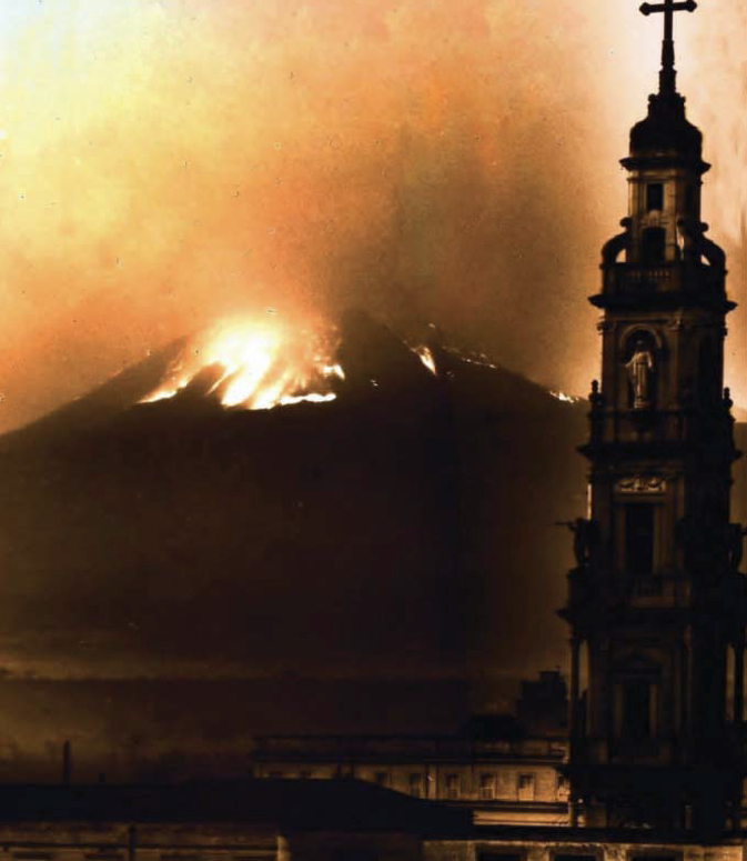
The following phase of activity was marked by various eruptions. There were numerous ones, even effusive, which counterpointed the nineteenth century, increasing the volume and raising the height of the Great Cone. The same happened in the twentieth century. A last great effusive eruption occurred between 16 and 29 March 1944 and was photographed for the benefit of posterity by American soldiers present in Naples.
The Somma-Vesuvius volcanic complex now
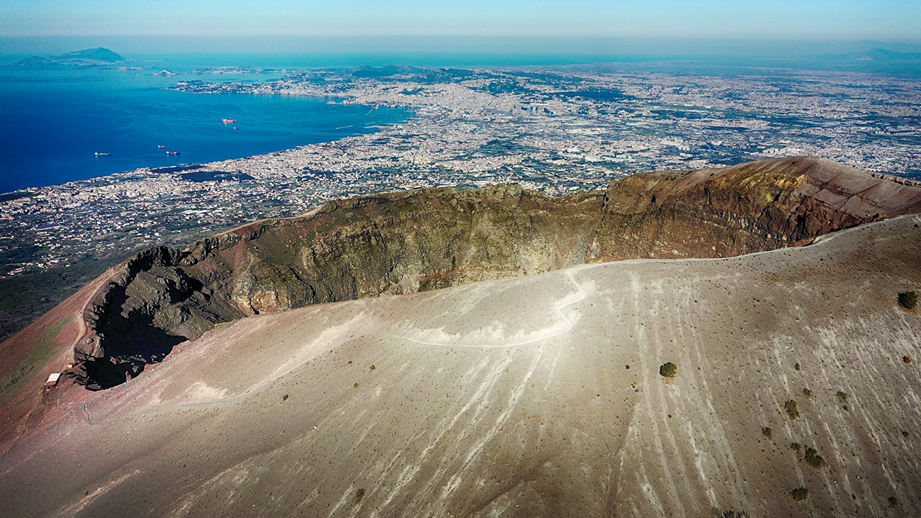
Monte Somma as we see it today is essentially what the inhabitants of Pompeii observed before 79 AD. At the highest point of its crest, Punta Nasone, it reaches 1132 metres. The other protuberances of the crest are known as Cognoli. At the base, its diameter is no less than 15 kilometers. Inside the caldera, the Great Cone of Vesuvius rises 1277 meters, with its characteristic truncated cone shape and crater with a diameter of 500 meters and a depth of 230. Separating the older extinct volcano from the still active younger one is the Valle del Gigante, with Valle dell'Inferno to the east, the scene of the last eruption in 1944, and the Atrio del Cavallo to the west. In the shared caldera there are the different eruptive vents of the lava flows of the last centuries. Somma and Vesuvius also share the same magma chamber, which is about 8-10 km deep and covers about 400 square km.
A large volcanic complex that contains 230 species of minerals, of which 62 are typical and 6 exclusive to the place. A marvel of nature which is also one of the symbols of Campania, a constitutive element of the landscape and of the image of Naples known and immediately identified throughout the world.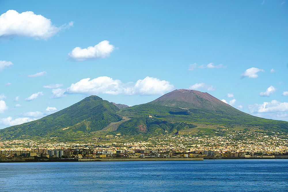
Ph:@Angelo Ammendola/Archivio Parco Nazionale del Vesuvio

Comments powered by CComment