“From these solitary heights I prefer to turn my back to the green hills of Massa and Sorrento, to Vesuvius and to Naples.
To Ischia and Campi Flegrei, to look down towards the mysterious South, towards the mountains of Basilicata, the fabulous Punta Licosa [...] a vision of peace, accompanied by not well-defined feelings of love and affinity for this element that surrounds us, feelings dating back to the ancient days of life
Norman Douglas, Siren Land
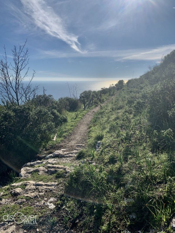 We are in the Regional Park of the Lattari Mountains, established in 2003. A mountainous massif like that of the Lattari allows you to make infinite journeys. The protected area has a lot to tell and includes very different realities and contexts embracing both coasts, Amalfitan and Sorrentine. The beauty that comes from the presence of a rich and prestigious environmental, naturalistic, landscape and cultural heritage. An alternation of colors of a multifaceted and wonderful landscape, in a smiling and uncontaminated nature. In a few kilometers it goes from mountains to sea, from steep slopes to gentle terraces. The path that we present to you today is a suggestive ring route of about 9 km, which runs along the southern slope of the Sorrentine Peninsula, crossing three of its municipalities: Massa Lubrense, Sorrento and Sant’Agnello. Its name, path of the Sirenuses, comes from the ancient name of the Li Galli archipelago, a tiny group of rocks in the middle of the sea, also known as Sirenuse due to the fact that it was home to the Sirens who bewitched Ulysses during his journey. The path that starts from Sant'Agata to reach Colli di Fontanelle is a dive in the colors and scents of the Mediterranean scrub, articulated along cliffs, terraces, gullies and suspended between sky and sea. From Sant’Agata we reach the hamlet of Torca and after a while that of Monticello, where the dirt path begins.
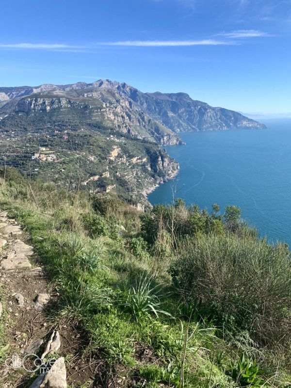
The first part of the route is very gentle and shaded, up to Pizzitiello area, a promontory on top of the cliffs of Punta Sant'Elia (489m a.s.l.), where there is a small uphill stretch, rewarded by a suggestive panorama on the Li Galli islets, along the entire peninsula until we get lost among the “faraglioni” of Capri, the Amalfitan Coast and the entire Gulf of Salerno. From here we go down towards the Colli of Fontanelle and, after crossing a chestnut wood, We reach the road (ss145). From here we climb to the upper part of the path that leads back to Sant’Agata and cross the pinewood of Tore (at the moment, unfortunately, access to the tree-lined area is forbidden and we can only go outside).
ROUTE INFORMATION
Duration: from 2 and a half to 4 hours
Difficulty: E
Length: 9 km
Difference in height: about 300m
The starting and finishing point is the hamlet of Sant’Agata on the two Gulfs in Massa Lubrense. You can reach the center of Sant’Agata by car or by Sita buses. Or if you want a shorter tour without giving up wonderful views, you can get to the hills of Fontanelle and from there take a short stretch to the Pizzitiellos promontory.
EQUIPMENT
-Trekking Shoes
-Layered technical clothing
-Sufficent water and packed lunch
-Telescopic poles
Good steps,
Veronica Verde,
Environmental Hiking Guide

Comments powered by CComment