When we think of Agerola, the Path of the Gods immediately comes to mind, which is now a must-do for a holiday on the Amalfi Coast.
But is that the only path? The answer is: absolutely not! Being located in the heart of the Lattari Mountains, Agerola is the starting point of many paths of different difficulty. Paths allowing walkers to experience completely unexpected dimensions: coastal valleys surrounded by steep limestone walls, where silence reigns. Or solitary peaks, where the view sweeps across Campania. Now it’s time to tell you about one of these many splendid paths: the path to Santa Maria dei Monti.
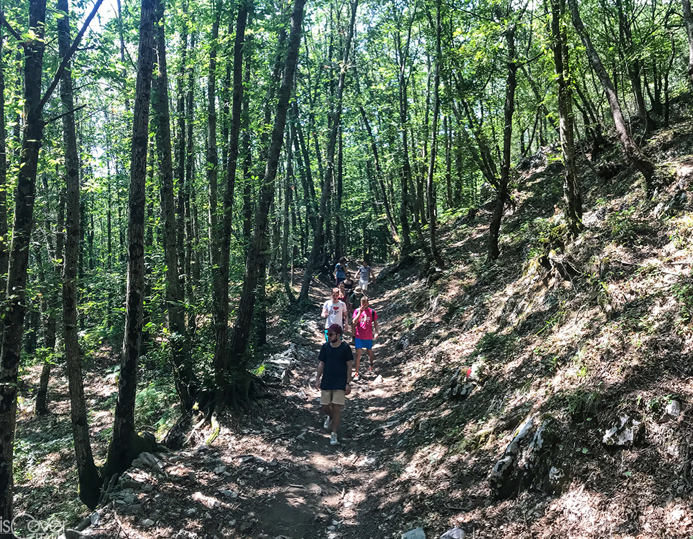
The start of this route is near the tunnel Palombelle, at an altitude of 700 meters in the hamlet of Campora. It is possible to park the car along the straight road as soon as you leave the tunnel. The climb begins along one of the ancient mule tracks used by the people of Agerola for hundreds of years: until the opening of the tunnel in 1880, this was one of the main routes that allowed the traveler to reach the north side of the mountains, or the Stabiana area. , but also Scala, Ravello or Amalfi itself, taking a slightly longer tour. The steps, quite wide and pleasant despite the slope, goes up to the left side of the Penise valley to the intersection with path 300 or Alta Via dei Monti Lattari, at an altitude of 930 m.
Once at the intersection, you may notice some ruins on your right, when not covered by vegetation. They are all that remains of a small church with a military lookout attached called Sant'Angelo a Jugo, dating back to the 10th century: the name itself, Jugo, from the Latin jugum (crest), suggests that its location was strategic for the control of the ancient mule tracks of this part of the mountains Back to our steps, once we reach the intersection we turn right, continuing on path 300. After a kilometer and a half along the Alta Via, we arrive at Imbarrata or Ammarrata: from this point you will enter the Nature Reserve Valle delle Ferriere. Yes, you got it right: the reserve embraces not only the part near Pontone, but also the whole upper part of this enchanting coastal valley up to 1203 meters of Monte Cervigliano, where the Canneto or Chiarito river originates and flows into Amalfi.
Looking carefully at the land that surrounds you, you will notice that are not just the chestnut trees to welcome you inside the reserve, but also the ancient Ice houses: preserving snow, visible today in the form of large circular pits in the ground, are to be counted among the many small industries of the past, now forgotten. It is well known that our ancestors used every natural resource available for their small economic activities. What not everyone knows, however, is that the ice houses are not only on Mount Faito, where it is possible to admire them in the shade of the beech trees, but also in other points at higher altitudes of the Lattari Mountains, such as Cervigliano in our case, Mount Cerreto, but also near Santa Maria dei Monti itself. Some local historians tell us that in ancient times the ice houses were also located in the hamlet of Agerola.
The beauty of the walk, as I anticipated before, is this: after a couple of hours you will find yourself in the highest part of the drainage basin of Amalfi, and after a while you will move to the Scalese / Atranese one. The highest part of the mountain range, in fact, has this particularity: it is the point where, relatively close to each other, many watercourses originate, hardly perceivable as close if seen from the sea. Another fascinating aspect of this stretch of the path is that it is flat: being at the top of the mountain range, for your great surprise, you will find some flat areas and really pleasant stretches with little difference in height.
After continuing for a kilometer and a half in the shade of chestnut trees along the southern flank of Mount Cervigliano, you will come to an intersection of several paths: you have arrived at Mount Rotondo. Until a few years ago, finding your way around this precise point was hard, since the CAI signage was almost absent. Luckily today this is no longer a problem: not only you will find the official updated signs, but you will already notice the sign of the refuge of Santa Maria dei Monti, that will direct you to the locality of the same name. If you have run out of water at this point of the walk, you can turn left to head towards the water of Vrecciaro. This detour, however, will cost you an extension of the journey of about half an hour in total between going, stop and returning at the Monte Rotondo intersection.
Leaving path 300 to continue along a part of 301, you will begin to notice more and more the trapezoidal mass of Mount Cervigliano behind you, where you have been few moments ago. After walking for a while with the fence of the reserve on your right, you will notice a sudden change of landscape: it is the Ceraso plain. Crossing this small flat area, you will finally arrive at the refuge. Located in the municipality of Scala, Santa Maria dei Monti is a place known for the white statue of the Madonna ruling over the towns of Scala and Ravello.There was a small church here in the past, dedicated to St. Mary, whose bell tower was spaced apart to ensure that the sound of the bells spread to every village downstream: it is for this very reason that today the mountain where the refuge is located is called Campanaro.
From the refuge, the view from above dominates over the towns of Scala, Ravello and Maiori, on the crest of the Lattari Mountains and in the distance on the Picentini, the Alburni Mountains, and then the coast of Cilento up to Punta Licosa.
The total length (A/R) of the route that goes from Agerola to S. Maria dei Monti is 12 kilometers. The duration of the one-way walk is about 3 hours, so my advice is to dedicate a whole day to this beautiful walk.
Copyright video, foto e testi © 2020

Comments powered by CComment