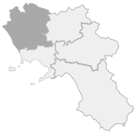
Three thousand kilometers from Canterbury, in Great Britain, across Europe, traveled since the Lombard era to reach first of all Rome, the main destination for pilgrims of the most varied origins, and then the Apulian coast at Santa Maria di Leuca, where there was one of the embarkations towards the Holy Land, also used by the Crusaders. It is the longest path in Europe, along roads and paths of England, France, Switzerland and Italy, from north to south, touching sixteen regions and six hundred municipalities, and having as its fulcrum the sacred places of Rome, largely in the City of Vatican. Of the long Italian route, 250 kilometers fall within the territory of Campania, from Sessa Aurunca to Buonalbergo.
Despite already having a history, the route took the name of Francigena in the 8th century when, with the descent of Charlemagne into the Peninsula and the annexation of northern Italy, much of the route fell into the kingdom of the Franks. For a first detailed description of the medieval itinerary to Rome, however, we will have to wait a couple of centuries, since the first travel diary on the Francigena was written by the English bishop Sigeric. Starting from the Eternal City, where he had received the bishop's pallium from Pope John XV, he traveled backwards in 79 stages up to Canterbury between 990 and 994. Even later is the description of the long stretch after Rome, towards the south, present in the "Privilegium Baiulorum Imperialum" of 1024. But the southern itinerary had already been outlined in the Lombard era, by the faithful heading to the sanctuary of San Michele arcangelo, patron saint of the Lombards , on the Gargano. The new path towards the Holy Sepulchre, widely frequented since the 11th century, used the Via Appia for large stretches, especially in Campania, between Capua and Benevento, from where it overlapped with the Via Traiana.
After many centuries, the rediscovery and revaluation of the Via Francigena officially began in 1994, when it was declared a cultural itinerary by the Council of Europe. Since then, all the redevelopment, reporting, valorisation and dissemination projects have started in the various states, including Italy, with the active involvement of local authorities, regions, provinces and municipalities, and the communities involved. And with the creation of a European network of locations touched by the Francigena.
There are nine stages of the Via Francigena del Sud in Campania, which can be covered on foot, by bicycle or on horseback.
The first stage which concerns Campania, which is number 12 of the southern journey, begins in Minturno, still in Lazio, crosses the regional border and reaches Sessa Aurunca, after 24.2 kilometres. The 13th goes from Sessa Aurunca to Teano, for 15.4 kilometres. The 14th stage connects Teano to Statigliano, a hamlet of Roccaromana, in 22.1 kilometres. The 15th from Statigliano reaches Alife, after 17.2 kilometres. The 16th from Alife enters the Matese for 19.3 kilometers up to Faicchio. With the 17th from Faicchio you enter the Sannio up to Telese Terme after 12.5 kilometres. The 18th stage starts from Telese Terme and in 19.1 kilometers leads to Vitulano. The 19th from Vitulano leads to Benevento in 19.1 kilometres. The 20th from Benevento reaches Buonalbergo in 23.8 kilometres. The 21st begins in Campania in Buonalbergo and ends in Celle San Vito in Apulia, in the province of Foggia after 31.7 kilometres


Comments powered by CComment